What kind of paper is this?
This is a Systematization paper (see taxonomy) that organizes and unifies decades of observational data from multiple planetary missions into a coherent geological framework for Venus.
What is the motivation?
Venus and Earth are planetary twins, nearly identical in size, mass, and bulk composition. Earth developed a biosphere. Venus developed a surface temperature of $\sim 740;\text{K}$ ($\sim 467^\circ\text{C}$) and a 93-bar $\text{CO}_2$ atmosphere.
Why did two similar planets diverge so drastically?
Basilevsky and Head synthesize decades of data to answer this. By decoding the geological record preserved in the Venusian crust, they aim to reconstruct the planet’s thermal evolution and understand why Venus operates under a “stagnant lid” regime characterized by a geological cycle of catastrophic global resurfacing.
What is the novelty here?
The paper’s contribution is a comprehensive synthesis integrating findings from Soviet Venera landers and NASA Magellan radar imaging into a unified geological history. Key novelties:
- Global Stratigraphy: Establishes a planet-wide sequence of geological units:
- Tessera Terrain: The oldest, highly tectonized crust, forming “islands” and “continents” above the plains (~8% of the surface).
- Densely Fractured Plains: Widespread, heavily deformed volcanic plains showing global-scale extensional and shear fracturing.
- Ridge Belts: Linear bands of folded, compressed material (~3–5 km wide ridges), a transitional tectonic phase.
- Shield Plains: Widespread fields of small volcanic shields (5–15 km diameter), emplaced after the ridge belts.
- Wrinkle-Ridged Plains (Regional Plains): The predominant variety of regional plains (which together with shield plains cover ~70% of the surface), consisting of vast basaltic lava flows marked by compressional ridges from gentle horizontal shortening.
- Younger Plains (Lobate/Smooth): The most recent volcanic flows, showing little deformation and comprising ~10–15% of the surface.
- Surface dominated by widespread basaltic volcanism and tectonic deformation, operating under a single-plate regime with no evidence of subduction trenches, island arcs, or mid-oceanic ridges.
- The Synchronous Model: Argues geological units (like regional plains) formed synchronously planet-wide, supporting global catastrophic resurfacing events rather than geographically asynchronous activity.
What experiments were performed?
This review synthesizes observational data from multiple spacecraft missions spanning four decades:
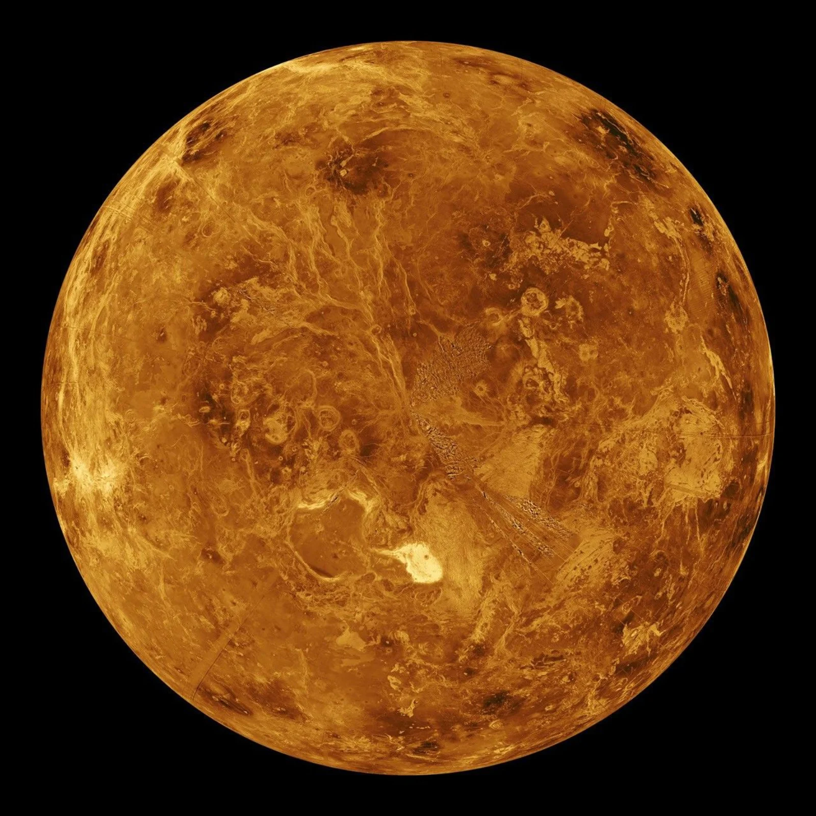
- Radar Imaging and Altimetry (Magellan, 1990–1994): Global high-resolution mapping (120–220 m/pixel SAR, altimetry, emissivity), revealing the full inventory of volcanoes, tectonic features, and impact craters.
- Venera 15/16 (1983): First radar imaging of Venus from 30°N to the north pole at 1–2 km resolution, revealing tessera terrain for the first time.
- Lander Missions (Venera 9, 10, 13, 14; Vega 1, 2): TV panoramic cameras providing the first direct surface images; gamma-ray and x-ray fluorescence (XRF) analysis confirming tholeiitic basalt composition at most sites (Venera 9, 10, 14, Vega 1, 2), with Venera 8 and 13 indicating alkaline basalt composition. The Venera 8 landing site, dominated by shield plains, showed elevated potassium, uranium, and thorium, suggesting geochemically evolved material.
- Atmospheric Probes (Pioneer Venus, Venera 4–12): Atmospheric composition, temperature, and pressure profiles, plus high D/H ratio ($\sim 0.024$, about 150$\times$ Earth’s oceans) indicating significant primordial water loss.

The Surface Environment
The Venera landers provided the only direct ground-truth of Venusian surface conditions:
- Temperature: $\sim 740;\text{K}$ at mean surface level ($\sim 6051.5$ km radius), varying by altitude. Maxwell Montes (the highest peak, $+11$ km) reaches $\sim 650;\text{K}$; deep depressions ($-2$ km) reach $\sim 755;\text{K}$.
- Pressure: 93 bar at mean surface level, 45 bar at Maxwell Montes summit.
- Winds: Very low near-surface wind speeds ($0.3\text{–}1;\text{m s}^{-1}$) at lander sites, but the zonal wind at cloud top reaches $\sim 100;\text{m s}^{-1}$, driving the planet-wide atmospheric super-rotation.
- Surface appearance: The solid surface is very dark and reddish (reflectivity only 0.03–0.1 in visible light). All four Venera landers photographed platy rocks with prominent fine layering and soil in local depressions, consistent with either lithified aeolian sediment or thin volcanic tuff. At the Venera 13 and 14 sites, rock bearing capacity was measured at only $3\text{–}10;\text{kg cm}^{-2}$, implying porous material.
- Chemical weathering: Thermodynamic calculations predict that basaltic minerals react with atmospheric gases to form magnetite, haematite, quartz, magnesite, anhydrite, and pyrite. In the highlands, above a critical altitude (which varies along the planet), iron in silicates segregates into highly conductive iron oxide or sulfide minerals, producing a radar-bright “snow line.”
Geological Terrains and Features
Volcanic Plains (80% of Surface)
The vast majority of the surface consists of volcanic plains. Regional plains (including both wrinkle-ridged and shield varieties) cover ~70% of the surface. The dominant variety, plains with wrinkle ridges, consists of solidified basaltic lava flows deformed by gentle horizontal compression into networks of narrow (1–2 km wide), low (tens to hundreds of km long) ridges. Within the plains run sinuous channels (lava tubes or thermal erosion channels), including Baltis Vallis, the longest channel in the solar system at 6,800 km, about $\frac{1}{6}$ of Venus’s circumference.
Younger volcanic units (10–15% of the surface) include lobate lava fields (over 200 fields each $> 50{,}000;\text{km}^2$) and smooth plains, representing the most recent volcanism. The highest volcano, Maat Mons, stands 9 km above MPR and its lava flows extend 800 km across.
Coronae: A Uniquely Venusian Feature
Several hundred coronae are among the most distinctive structures on Venus. These oval-to-circular volcanic-tectonic features are typically 100–300 km in diameter (a few exceeding 1,000 km) and are unique to Venus in the solar system. A corona typically consists of:
- A tectonically deformed annulus (circular rim of compressed/fractured terrain) standing a few hundred metres above the surrounding plains.
- A depressed interior flooded with plains-forming volcanics.
- Aprons of young lobate lava flows radiating outward from the annulus.
Coronae form from rising hot mantle diapirs: the diapir pushes up the overlying lithosphere and crust, producing magmatic melts that reach the surface as lava flows. When the diapir cools, the uplifted surface collapses, creating the annular structure. Their long-lived circular geometry (rather than being deformed into elongated shapes) is strong evidence that plate tectonics did not operate during their formation.
Deformed Terrains (20% of Surface)
About 20% of the surface is occupied by rough, tectonically deformed terrains:
- Ridge belts: Fragments of globally widespread compressed plains-forming material, now partly flooded by regional plains lavas. Their folded ridges (3–5 km wide) indicate past regional-to-global horizontal compression.
- Densely fractured plains: “Islands” of 100–200 km extent of heavily fractured plains-forming material, elevated slightly above regional plains. Fracture patterns are often subparallel within a given island, implying global-scale deformation events.
- Tessera terrain: The most highly deformed and probably oldest surface unit, forming elevated “islands” and “continents” (e.g. Ishtar Terra at 60–70°N, Fortuna, Ovda, Tellus). The surface is dissected by criss-crossing ridges and grooves a few km wide and tens of km long. Composition is unknown; may be basaltic or more feldspathic (resembling lunar anorthosites or terrestrial granites).
- Rifts (Chasmata): A global system of extensional troughs up to 40,000 km long, with floors a few km below surrounding terrain. Associated with young post-regional-plain volcanism and coronae chains.
- Mountain ranges: The highest topographic features (Maxwell Montes, 11 km above MPR), formed by intense horizontal compression. Lateral merger with tessera suggests mountain range formation may be the initial stage of tessera formation.
Impact Craters
More than 960 impact craters from 1.5 to 270 km in diameter have been identified on Venus. Their distribution is indistinguishable from random, confirming no plate tectonics (which would preferentially destroy craters). Key characteristics:
- Atmospheric screening: The dense atmosphere breaks up relatively small projectiles, so craters smaller than $\sim 10\text{–}20$ km in diameter have irregular floors caused by impacting swarms of fragments rather than single bodies. The observed size-frequency distribution is well-matched by models of the present-day atmosphere.
- Impact melt outflows: Many craters show flow-like outflow features (impact melt) extending tens to hundreds of km from the rim, more abundant than on other planets due to the high surface temperature increasing melt production.
- Dark parabola halos: The youngest craters are associated with radar-dark parabolic haloes formed by fine crater ejecta carried westward by the strong zonal upper atmosphere winds and settled in a parabolic pattern. Parabolas degrade to non-parabolic halos with age, providing a crater aging tool.
Aeolian Features
In the absence of liquid water, aeolian (wind) processes dominate exogenic resurfacing:
- Wind streaks: The most abundant aeolian features. Elongated radar-dark or bright features a few to tens of km long, originating from topographic obstacles; represent erosional and depositional products of wind turbulence.
- Dark mantles: Fine-grained debris from impact ejecta, deposited atmospherically and redistributed by wind. Common around impact craters as halos.
- Dunes: Only two dune fields identified (one near Fortuna–Meshkenet, one in Lavinia Planitia), each associated with large impact craters that provided debris. The scarcity of dunes implies a general deficit of sand-sized particles on Venus.
- Candidate yardangs: Wind-erosional grooves observed near the Mead crater (the largest impact crater on Venus).
The Age Debate: Synchronous vs. Non-Synchronous Resurfacing
A central unresolved question is whether similar geological units across the planet share the same absolute age or different ages:
- Synchronous model (favored by authors): Similar units are globally contemporaneous. Evidence: mapping of more than half the planet shows consistent age-sequence relationships across province boundaries; a complete latitude band mapped at 30°N shows the unit sequence is laterally traceable around the planet.
- Non-synchronous model (alternative): Unit L in one province may be younger than unit L in a neighboring province (the same stratigraphic position reflects local, not global, timing). Distinction requires fossil biostratigraphy or isotopic dating, neither of which is possible on Venus without sample return.
The synchronous model, if correct, implies a brief period of intense global volcanism and tectonism (resurfacing 80–85% of the surface), followed by a dramatic drop to the low-activity stagnant lid regime that persists today.
What outcomes/conclusions?

The authors conclude that Venus operates under a “stagnant lid” regime, fundamentally different from Earth’s plate tectonics.
- Mean surface age: $\sim 500\text{–}800$ Myr (range $\sim 300;\text{Myr}$ to $\sim 1;\text{Gyr}$ with uncertainties), inferred from crater density calibrated against lunar chronology. The pre-regional-plains units and regional plains (occupying 80–85% of the surface together) formed in a compressed time window during the early era.
- Two-era history:
- Global/Early Era: Intense, planet-wide volcanic and tectonic activity resurfaced 80–85% of the surface. Mean volcanic rate was comparable to Earth’s current mid-oceanic ridge volcanism. Tectonic deformation was most intense (tessera-forming) at the start, waning through ridge belts and wrinkle ridges.
- Localized/Late Era: Beginning $\sim 500\text{–}1000$ Myr ago and continuing to the present, activity dropped to rates lower than terrestrial intraplate volcanism and more comparable to lunar mare volcanism. Concentrated in rift zones ($\sim 4%$ of the surface); lobate and smooth plains occupy only 10–15% of the surface.
- The stagnant lid transition: Earth releases internal heat gradually through plate tectonics. On Venus, when the lithosphere thickened sufficiently, its yield strength exceeded the tectonic driving stresses (Solomatov & Moresi 1996), locking the planet into a single immobile plate. This caused mantle heating, suppressed melting that feeds surface volcanism, and halted the overturning cycle. Volcanic and tectonic activity may still occur at low rates.
- No magnetic field: Cessation of rapid core cooling (which plate tectonics drives on Earth) likely halted geodynamo action, explaining the absence of an intrinsic magnetic field despite Venus having an Earth-like iron core.
- Interior structure: The crust–mantle boundary sits at $\sim 70;\text{km}$; the mantle–core boundary at $\sim 2840;\text{km}$. Gravity correlates strongly with topography (unlike Earth), suggesting Venus lacks an asthenosphere (mechanically soft upper mantle layer), possibly because the high surface temperature precludes the stability of chlorite and serpentine, the “slippery” minerals that weaken Earth’s lithosphere.
- Surface-atmosphere coupling: Extensive early-era volcanism may have added $\text{H}_2\text{O}$ and $\text{SO}_2$ to the atmosphere, amplifying the greenhouse effect and causing $\pm 100;\text{K}$, 100–200 Myr surface temperature excursions that could in turn have driven tectonic stress and partial crustal melting.
Connecting to Venus as a System
The geological record decoded here provides essential context for understanding the full story of Venus. The stagnant lid and catastrophic resurfacing events explain how the planet lost its early surface water and why the atmosphere evolved into its current extreme state.
To explore what the surface conditions mean for life and planetary engineering, see:
- Life on Venus for how these surface conditions define the hard limits for any biology.
- Venus Evolution Through Time for the coordinated mission strategy that will answer whether Venus was ever habitable.
- Terraforming Venus: The Cloud Continent Proposal for a speculative look at how humanity might one day engineer around these geological constraints.
Reproducibility
This is a review paper synthesizing publicly available mission data. The primary datasets are accessible through NASA’s Planetary Data System (PDS):
| Artifact | Type | License | Notes |
|---|---|---|---|
| Magellan SAR and Altimetry (PDS) | Dataset | Public Domain | Global radar imagery and topography |
| Venera/Vega Lander Data (NSSDC) | Dataset | Public Domain | Surface composition and imagery |
No custom software or models are associated with this paper. Reproducing the geological interpretations requires access to the Magellan radar mosaics and familiarity with planetary geological mapping techniques.
Paper Information
Citation: Basilevsky, A. T., & Head, J. W., III. (2003). The surface of Venus. Reports on Progress in Physics, 66(10), 1699-1734. https://doi.org/10.1088/0034-4885/66/10/R04
Publication: Reports on Progress in Physics, 2003
@article{basilevsky2003surface,
  title={The surface of Venus},
  author={Basilevsky, Alexander T and Head, James W, III},
  journal={Reports on Progress in Physics},
  volume={66},
  number={10},
  pages={1699--1734},
  year={2003},
  publisher={IOP Publishing},
  doi={10.1088/0034-4885/66/10/R04}
}